CryoSurf
Project Description
The European Space Agency (ESA), Earthwave and The University of Edinburgh (UoE) have made significant progress with the completeness and accuracy of CryoSat-2 SAR-In Swath elevation models. However the scientific perfectionists in all of us strive for the next level using the latest technological tool set.
Ice-sheets are a current contributor to sea-level rise and the fresh water they bring into the oceans can impact global oceanic circulation with global consequences (Vaughan et al., 2013). It is thus very important to monitor ice-sheet elevation and elevation change. Spaceborne Radar and Lidar sensors have revolutionised our ability to monitor the mass imbalance of the cryosphere globally and its contribution to sea level change (Shepherd et al., 2012). Lidar (NASA, 2018) is often used in local airborne campaigns to obtain precise elevation measurements however these campaigns have limited spatial and temporal coverage and are impacted by by weather. Radar performs in all weather conditions but suffers from uncertainties due to time-variable penetration into snow and firn (McMillan et al., 2016; Nilsson et al., 2015).
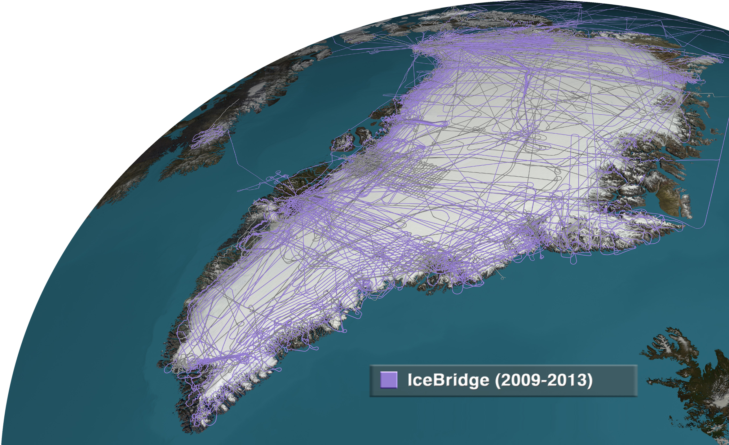
This project uses CryoSat-2 radar altimetry elevation and NASA’s operation IceBridge local airborne Lidar together in a multi layer neural network (NN) to create a timeseries of maps of penetration of CryoSat-2 Swath radar altimetry into the snow and firn. The map will be across large regions of the Greenland margins where CryoSat-2 is in SARIn mode going back to CryoSat-2’s launch in 2010. In addition, IceSat-2 data will be added to the framework for the period post its launch in 2018 enabling maps across a wider range of months beyond the operating window of Operation IceBridge.
As the penetration of the Ku microwave signal into the snow and firn relates to the condition of the surface, the maps generated during this project have the potential to be used to inform about surface conditions and change in surface conditions. Additionaly, the maps of penetration can be used to explore the impact of change in surface condition on Lidar and microwave signals and its impact on the use of radar and laser altimetry for the study of ice sheet mass balance and processes.
The results from this study were compiled into a peer reviewed paper: https://www.mdpi.com/2072-4292/14/24/6210.
The following also serves as a short introduction to the project, as presented at PhiWeek 2020:
Project Details
Project Duration:
- Kick Off: Jan 2019
- End: Jan 2021
Project Partners:
- European Space Agency
- University of Edinburgh